Expertise
Discover patterns and relationships in your data.
Capture, analyze, and display your data in 2D or 3D maps to gain better understanding from it. Our GIS experts employ the latest spatial analysis tools and techniques—from calculating statistics and summarizing and aggregating data to modeling relationships—to reveal key patterns that help you interpret your spatial data and apply insights from it effectively.
Spatial Statistics
Resource Data experts use advanced statistical methods and tools—including spatial autocorrelation, hot-spot analysis, spatial regression, and advanced algorithms during geoprocessing—and generate statistical summaries to help you make data-driven decisions. Whether it’s summarizing trends or performing complex spatial calculations of your data, our work supports accurate and actionable results.

Network and Proximity Analysis
Need to evaluate relationships and connectivity between different geographic features? We can trace routes, track events, and enforce topology rules so you know how features relate to each other spatially. With multiple datasets layered over a specific area of interest, you get a compounded view of your data, showing how different spatial elements interact. Understanding relationships between features and their surrounding environments enables you to make more informed decisions.
Spatial Relationship Identification
Determine key spatial relationships by analyzing intersections, unions, and combinations of features within your GIS datasets. We gather all your relevant data and identify associations across different spatial datasets, overlaying and aggregating information for more efficient analysis. Our team will summarize large amounts and types of data that you want quickly, improving efficiency and delivering valuable insights that are difficult to extract from large tables or maps.
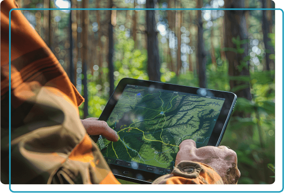
Terrain and Surface Analysis
Gain critical insight into how an area’s topographic features, elevation, and flow impact your projects. Resource Data experts conduct terrain and surface analyses that better prepare you to make decisions about site suitability, hazard assessment, landscape management, and more for your projects. Whether you want to classify and categorize land areas based on specific characteristics or track the flow of water through a hydrologic network, we deliver the information you need.
Pattern and Trend Detection
Recognize significant spatial elements and monitor changes over time based on observed trends. Using methods like cluster analysis, spatial-temporal analysis, and change detection, we detect patterns in your geographic data. Our team analyses these themes and recurring events to identify how specific environmental conditions influence spatial occurrences, revealing valuable insights and driving efficient use of resources, land, and more.

Predictive Spatial Modeling
Ground your future decisions in spatial intelligence. We use predictive spatial modeling to forecast outcomes based on existing geographic data in historical trends and identified patterns gathered from GPS and other technologies. By applying machine learning algorithms, regression models, and simulation tools, we create predictive models for you to anticipate changes, assess risks, and plan for future scenarios. Our team gathers and incorporates data sampling and field-verification data to improve the accuracy of our models so you can make forward-looking decisions tailored to your specific needs.
Our Clients
Hundreds of clients. Thousands of GIS projects.


We want to identify how Alaska Municipal League (AML), as a member services organization, can help meet the identified needs of our members. The data collection and identification of potential projects is important so that AML can better connect members with our technical assistance and support systems. Because of the Alaska Energy Hub that Resource Data developed, the Energy Ambassadors and community leaders now have a really easy path to submitting projects.
~ Nils Andreassen, Executive Director, Alaska Municipal League
Alaska Department of Natural Resources
Identifying and Advancing Infrastructure Projects
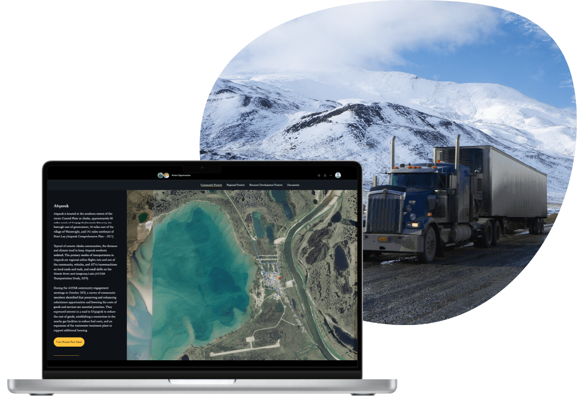
The Arctic Strategic Transportation and Resources (ASTAR) program aimed to identify and advance infrastructure projects that would enhance the quality of life and economic opportunities in North Slope communities.
Resource Data developed a comprehensive data-management plan that established standards, protocols, and technical strategies for data storage to support ASTAR work. Our team created an extensive inventory of GIS infrastructure datasets for the Arctic and conducted a thorough gap analysis. We developed a collection of new transportation and infrastructure datasets to address these gaps after working with the Alaska Department of Natural Resources (DNR) and their partners. The datasets became essential for prioritizing and selecting sites for Arctic infrastructure projects.
The DNR used the data-management tools and services we provided to generate detailed project information, outreach materials, and statistical analyses. This made it simple and efficient to evaluate and recommend projects that would benefit North Slope communities.
Midstream Oil and Gas Company
Streamlining Pipeline Data Management
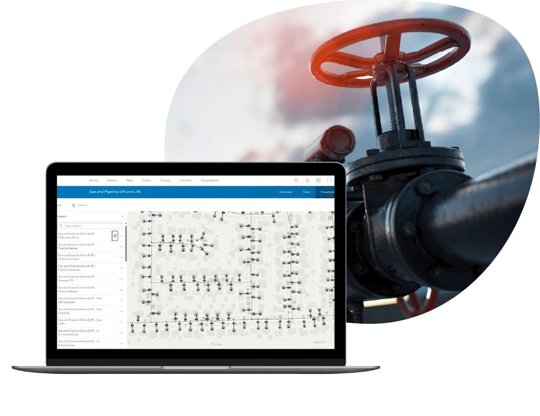
A San Antonio-based midstream company needed an authoritative system to manage their extensive pipeline and asset data. Their existing data was stored in a variety of feature classes. Because most of the attributes were open-text fields, it increased the likelihood of errors and inconsistent data entry.
Resource Data customized and deployed Esri’s Utility Pipeline Data Model (UPDM), an industry-standard schema, ensuring that all features and their attributes were standardized and mapped correctly. Our team trained the company’s IT and GIS staff on how to manage their assets and back-sync their production data with development and test environments.
The new data-management system standardized the way employees work with their data, boosting data accuracy and operational efficiency. Their new model’s sophisticated network-tracing tools improve essential analysis, management, and compliance reporting.
Gulf Coast Restoration Organization
Spatial analysis for environmental restoration
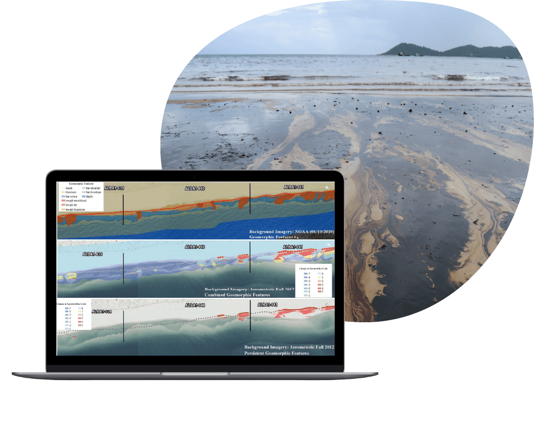
When a major oil spill occurred in the Gulf of Mexico, Resource Data built custom applications and led the GIS team that provided crucial spatial information in the spill-response efforts. After the crisis, the Gulf Coast Restoration Organization (GCRO) was established to manage and facilitate the use of this vast collection of data for environmental restoration, litigation, and scientific research.
Since the founding of GCRO, Resource Data GIS experts have provided a wide range of GIS data management and support. We have performed data cleanup, including creating “golden” datasets to reflect extensively validated and normalized information, conducted data analysis, and built custom tools. This has included a GIS and file-inventory tool that allowed analysts to locate files by type (photos, documents, GIS), collect metadata, and consolidate data into consistent and complete datasets.
Our work has been helping the client track potential environmental damage, demonstrate they completed cleanup requirements, and manage data for legal claims.

Oregon Salmon Commission
Promoting sustainable fishing with data
Collecting accurate information from commercial fishing catches is crucial to promoting sustainable fishing practices. But extreme conditions at sea made it difficult for fishers to collect and share reliable data.
Working with the Oregon Salmon Commission, Resource Data developed FishTrax—a custom mobile application designed to withstand extreme environments—and integrated it with a full website and web service for plotting, archiving, and analyzing fishing trips and commercial catches. The application’s powerful mapping capabilities and near-real-time data collection replaced outdated and unreliable methods to collect and share data. Fisheries managers, scientists, regulators, and marketers use these tools for enhanced data analysis, collaboration, and data-driven decision making.
Bureau of Ocean Energy Management (BOEM)
25 years of GIS services
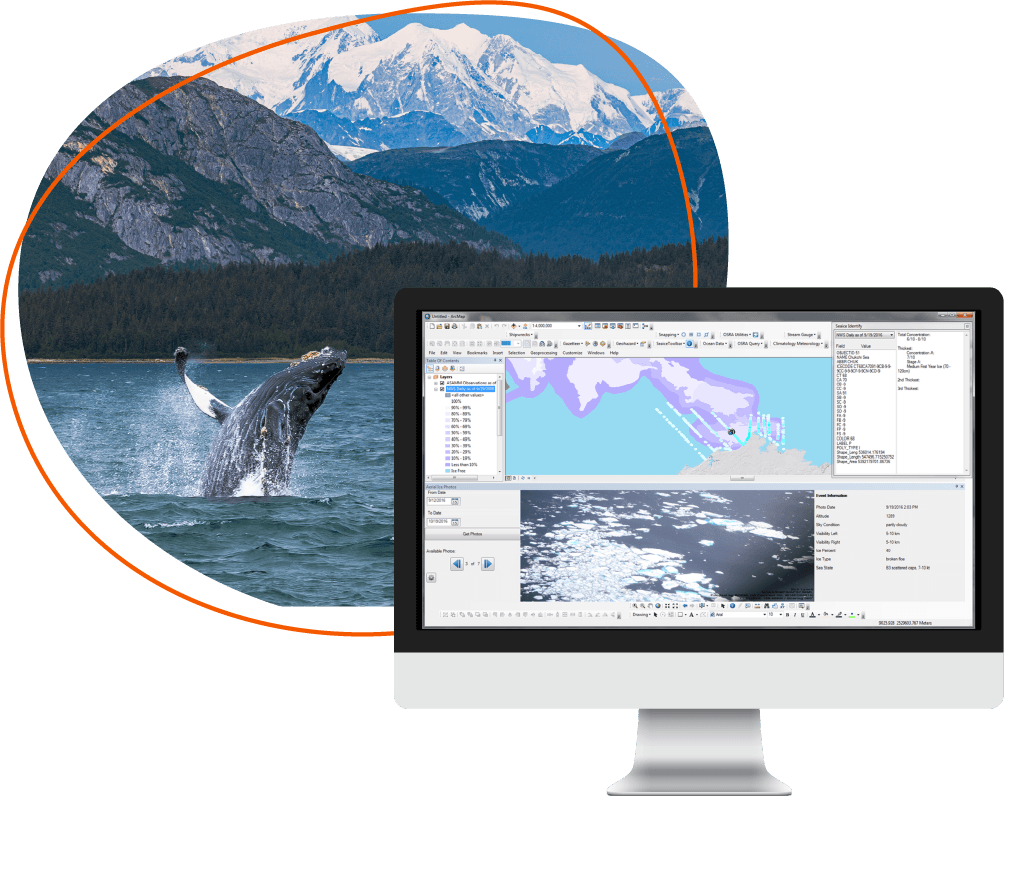
For 25 years, Resource Data has provided a variety of GIS services to BOEM, developing and maintaining 20+ geospatial applications, such as the
-
- Sea Ice Toolbar: Shows sea-ice conditions in an ArcGIS map. Users can integrate observations and analysis of ice layers with other physical, biological, and social data sets.
- Ocean Data Toolbar: Allows analysis of ocean conditions like temperature and currents.
- Office of Environment Map Viewer: A web app that allows users to view information and general locations of spatially enabled datasets.
- Oil Spill Risk Analysis (OSRA) Toolbar & Utilities: Displays and manages data to estimate potential oil spill risks associated with offshore activities.

Tasha Jackson
Service Area Lead, GIS
Tasha leads the delivery of innovative geospatial solutions for clients across all industries. Known for her technical excellence and strategic vision, Tasha has over 15 years of experience managing complex GIS and IT initiatives across industries, such as oil and gas, utilities, and state and local government. She is an expert at understanding our clients’ business objectives and guiding organizations through the practical use of GIS tools and products to make informed decisions.
Tasha’s expertise spans GIS solution design and architecture, spatial analysis, enterprise system integrations, and data governance. With a strong foundation in geography and natural resource management from Western Washington University, she combines academic rigor with a practical, solutions-oriented approach. Tasha leads with collaboration and innovation, directing project teams to deliver impactful, user-centered geospatial products. Under her leadership, Resource Data continues to set the standard for delivering GIS services which support our client’s strategic business goals.


