Expertise
Automate GIS processes. Boost efficiency and accuracy.
Leverage GIS technology to reduce manual work and simplify your geospatial tasks and workflows. Our team identifies and implements custom and commercial GIS technology—tools, toolboxes, widgets, and more—so you can perform geospatial tasks automatically. We’ll automate your recurring and triggered processes, from data updates and backups to notifications, allowing you to focus on what matters most for your business.
Workflow Automation
Modernize your business processes and reduce manual work by automating geospatial workflows and data transactions. Our automation solutions drive processes through decision trees or process flows and trigger data transactions, alerts, and geoprocesses—freeing you and your staff from all that data entry. Automation also manages status transitions, guiding your projects through each phase and ensuring efficient workflow management without manual intervention.

Script Development
Our experts use scripting to develop tools, widgets, extensions, and more that automate your geospatial tasks and processes. When commercial solutions don’t meet your needs, we create custom scripts that align with your unique business rules and use cases. Automate manual processes into a single script or link multiple geoprocessing scripts together for end-to-end workflows and complex geospatial analysis. Whether for one-time bulk data processing or recurring tasks, our scripts can simplify operations to a single click.
Automated Task and Process Management
Reduce your staff’s workload and ensure that critical operations are completed on time, every time. We set up batch processing, task scheduling, and triggered processes to streamline your recurring geospatial tasks. Whether triggered by user and system actions or scheduled at regular intervals, these automated processes handle large volumes of data so you get consistent, reliable execution without manual intervention. With these workflows set up, your systems run autonomously and complete tasks like data updates, notifications, and complex geoprocesses efficiently.

Data Integration and Synchronization
Make your data flow seamlessly between different systems. We automate integration and synchronization processes so you can sync data across multiple databases or automate data transformations and loading. Our solutions ensure your geospatial data remains consistent and up-to-date—across all platforms—giving you the accurate, real-time information you need to improve decision-making and operational efficiency across distributed systems.
Our Clients
Hundreds of clients. Thousands of GIS projects.


We hired Resource Data and created a mappable GIS database. We are using it and it is terrific! We are very appreciative of their work and what they’ve done so far. It’s paying dividends.
~ Hugh Wade, Owner, Spire Commercial
Boise School District
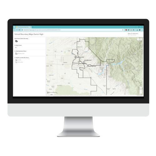
Updating GIS for better zoning and bus boundary management
Boise School District (BSD) tracked and managed school attendance zone boundaries, routed buses, and determined student eligibility to ride buses using a local GIS. But with zone boundaries changing frequently and its systems not keeping up, the District became overwhelmed with managing the high volume of complex GIS data and keeping it updated.
Resource Data replaced the old PDF maps BSD was relying on with online, interactive maps for school zones, from elementary to high school. We built an automated process to determine student eligibility for riding buses, wrote custom scripts to automate internal processes, and upgraded the District’s GIS to the latest enterprise software. These modern and reliable systems have helped BSD staff manage and update GIS data efficiently. It’s also easier for parents to check whether their kids are eligible to ride the bus to and from school.

Electric Utility
New online capabilities for faster electrical service extension
Customers of a major western energy company submitted electrical service extension and construction requests through handwritten forms or phone calls. Utility staff then manually entered the information into spreadsheets. It became difficult and time-consuming for staff to track and process these requests so they could move into the design and construction phases of projects.
Resource Data created online forms with GIS components for customers and staff to submit requests. This information is automatically entered into a workflow for the construction team to review requests, design how lines would run, provide estimates, and more. We also integrated systems across the company, leading to significant time savings for staff, streamlined document management, and improved coordination between departments.
City of Abilene, TX
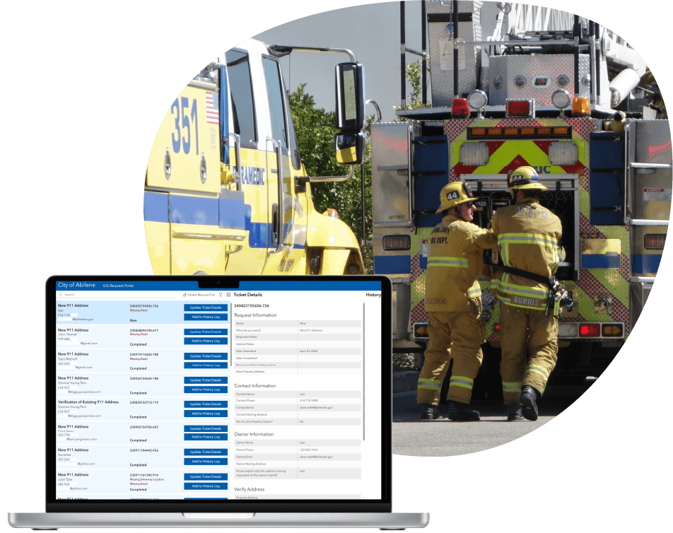
911 Addressing solution expedites address allocation
Cities and counties nationwide rely on accurate 911 response and addressing systems to ensure emergency responders know exactly where to go. When the City of Abilene was down to a single GIS staff member, a significant backlog of critical 911 addressing requests accumulated.
Our team of GIS experts was called in to address the backlog and streamline the request submission and management processes. By implementing Esri’s Survey 123 and Experience Builder, we replaced the time-consuming and error-prone process with a more efficient and user-friendly solution.
Address processing times were cut by 50%. These new tools not only improved the City’s operational workflows but also simplified the process for public users who now submit 90% of their requests online.
Oil and Gas Company
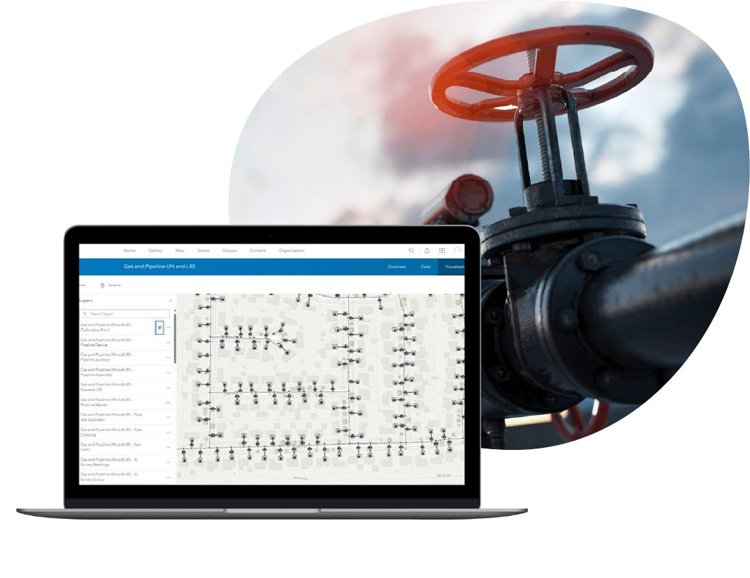
Improving Pipeline Data Management
A San Antonio-based midstream company needed an authoritative system to manage their extensive pipeline and asset data. Their existing data was stored in a variety of feature classes. Because most of the attributes were open-text fields, it increased the likelihood of errors and inconsistent data entry.
Resource Data customized and deployed Esri’s Utility Pipeline Data Model (UPDM), an industry-standard schema, ensuring that all features and their attributes were standardized and mapped correctly. Our team trained the company’s IT and GIS staff on how to manage their assets and back-sync their production data with development and test environments.
The new data-management system standardized the way employees work with their data, boosting data accuracy and operational efficiency. Their new model’s sophisticated network-tracing tools improve essential analysis, management, and compliance reporting.

Tasha Jackson
Service Area Lead, GIS
Tasha leads the delivery of innovative geospatial solutions for clients across all industries. Known for her technical excellence and strategic vision, Tasha has over 15 years of experience managing complex GIS and IT initiatives across industries, such as oil and gas, utilities, and state and local government. She is an expert at understanding our clients’ business objectives and guiding organizations through the practical use of GIS tools and products to make informed decisions.
Tasha’s expertise spans GIS solution design and architecture, spatial analysis, enterprise system integrations, and data governance. With a strong foundation in geography and natural resource management from Western Washington University, she combines academic rigor with a practical, solutions-oriented approach. Tasha leads with collaboration and innovation, directing project teams to deliver impactful, user-centered geospatial products. Under her leadership, Resource Data continues to set the standard for delivering GIS services which support our client’s strategic business goals.


