In Brief
Easy data collection tool for quality results and streamlined processes
Cities and counties nationwide rely on accurate 911 response and addressing systems to ensure emergency responders know exactly where to go. When a midsize city in Texas was down to a single GIS staff member, a significant backlog of critical 911 addressing requests accumulated.
By implementing Esri’s Survey 123 and Experience Builder, Resource Data’s GIS experts addressed the backlog and streamlined the request submission and management processes. Address processing times were cut by 50%. These new tools not only improved the City’s operational workflows but also simplified the process for public users who now submit 90% of their requests online.
Key Takeaways
Faster, more accurate address processing
-
Simple, cost- and time-saving solution
With Esri’s Survey 123 and ArcGIS Experience Builder, the City has a cost-effective solution with a platform they already know. Address processing times were reduced by 50%, saving valuable time.
-
More transparency and easy access to information
Using the Survey 123 form for addressing requests makes it easier for public users to see what information they need to provide. With automatic confirmation of submissions and a tracking number, they’re confident their requests were received.
-
Improved workflows and reduced processing times
A searchable Experience Builder portal replaced time-intensive Excel spreadsheets and gave the City’s GIS department better insight into request statuses and volumes.
-
Tracking critical information in one place
The system automatically flags missing details like access points and deeds, making it easier to identify outstanding requirements. It allows for status updates, enhancing the City’s ability to manage, search, and review requests.

The Challenges
Voicemails, emails, and spreadsheets to collect and process critical requests
The City serves as the county seat, boasting a population of around 125,000. Addresses are crucial for various purposes, including emergency response, utility services, mail delivery by the USPS, as well as zoning and planning. Previously, residents and business owners would request addresses via phone calls, voicemails, and emails. Then the City’s GIS team assigned the appropriate number and street name, and added a point address for a more precise location.
Delays from incomplete information and limited process visibility
Address designation was often hampered by customers providing insufficient details, requiring several calls to collect more information. In addition, the City’s GIS staff manually input and managed information in Excel spreadsheets.
These methods were time consuming, inefficient, and prone to errors. This approach also had limited visibility and lacked insights, leading to requests potentially being overlooked or delayed. The City needed a better way to collect and process information and easily track customer interactions.

The Solution
Simple solutions, big impacts
Facing a severe GIS staff shortage and growing backlog of critical 911 addressing tasks, the City’s Chief Information Officer (CIO) and Director of Information Technology—and former Resource Data client while serving as CIO at the Anchorage Water and Wastewater Utility—turned to us for assistance. He hoped we could not only alleviate the existing backlog but also implement technology solutions for process improvement.
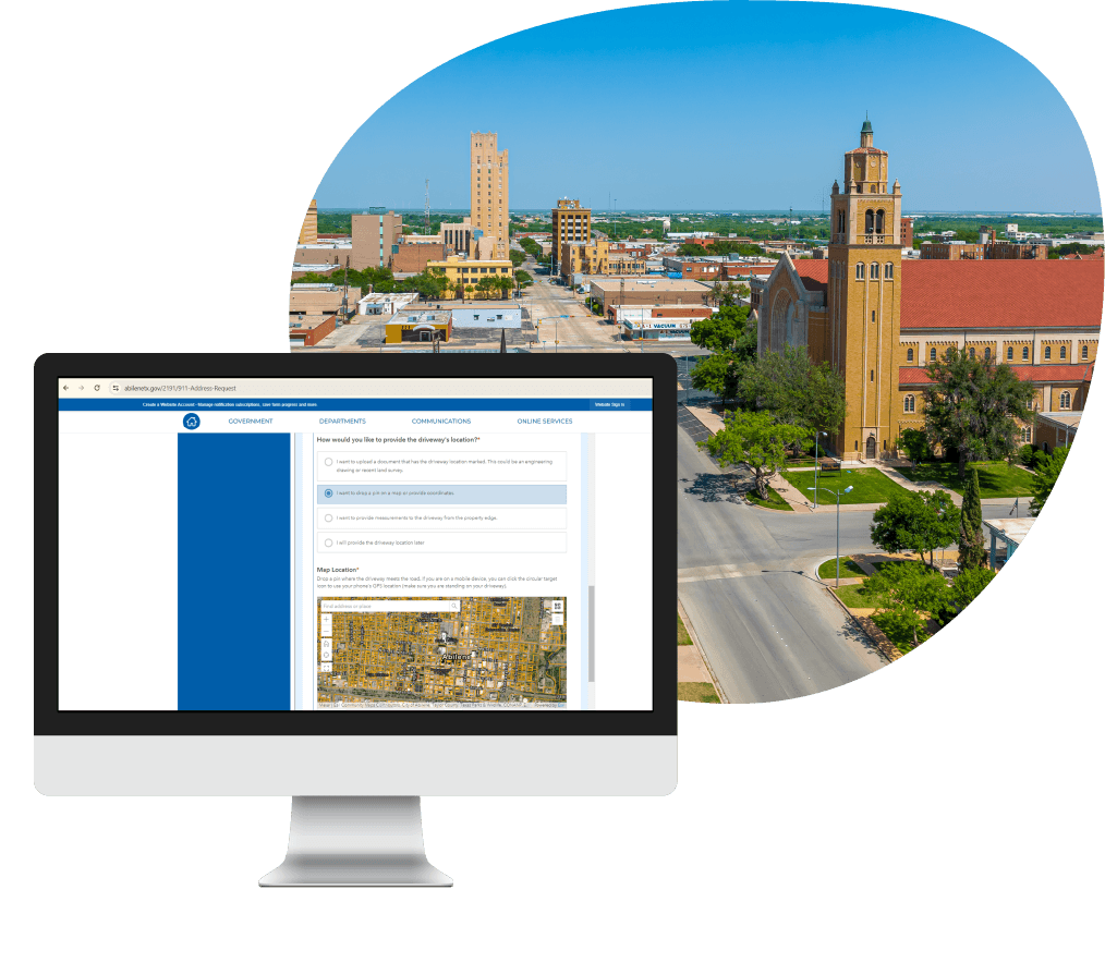
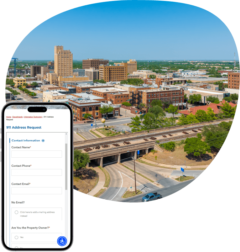
Our GIS team prioritized the backlog of urgent requests before creating a more efficient system for managing 911 addressing requests. With existing Esri licenses, we developed a cost-effective solution using Esri’s Survey 123 and ArcGIS Experience Builder. The Survey 123 online form lets citizens submit requests on the City’s website. The form makes it easy to see what initial information is required and they receive a confirmation ticket number.
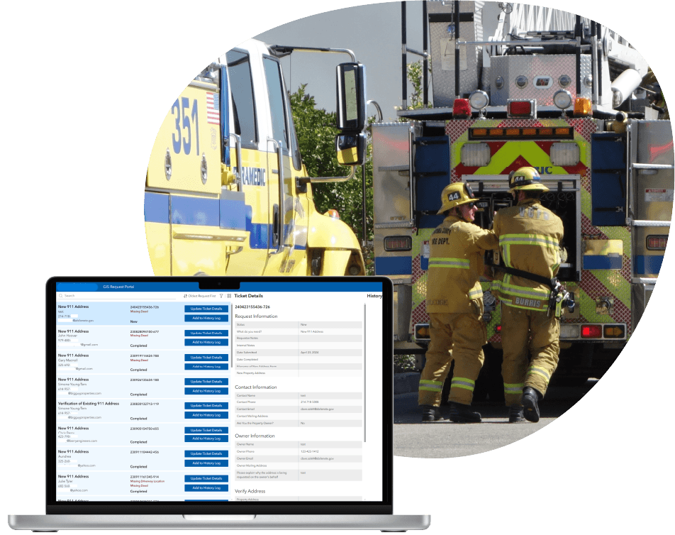
We replaced Excel spreadsheets with a searchable Experience Builder portal, giving the GIS department better control over request status and volumes. The system also automatically flags missing details like access points and deeds, making it easier to identify outstanding requirements. And statuses enhance the City’s ability to manage, search, and review requests.
Features
Streamlined data collection and processing, increased transparency, and optimized workflows with Esri solutions
-
User-friendly form for easy submission and transparency
The online Survey 123 form makes it easy for customers to submit requests at any time. Each request is confirmed upon submission and automatically receives a ticket number for tracking and better customer service.
-
Form prompts for complete information and shorter response times
When certain answers are selected, the form generates related questions. This prompts customers to provide more complete information and reduces the need for follow-up.
-
Enhanced filter for simple searching
Users easily find relevant address information by searching or filtering with name, ticket number, email, new address, date, status, and request type. Location data is easy to view on maps by using property ID or nearest neighbor’s address.
-
Automated flags for identifying missing information
The automated system flags missing information so it’s easy to pinpoint what’s still needed and resolve issues. Statuses such as complete, in progress, waiting for requestor response, or waiting for clearance, can be assigned by staff.
-
Time stamps and history log for better tracking
Within the Experience Builder portal, City and County departments can track where customers are in the addressing-assignment process. This improves communications and makes it easier to assist customers.
-
Integrated systems for accurate data
Experience Builder integrates with other City and County systems like CAD, Parcel data for the County, and MyGov, ensuring address and point data is up to date and accurate—this is crucial for routing first responders correctly in emergencies.

Results
Processing time cut in half
The additional GIS staff and new tools Resource Data provided have streamlined workflows, increased transparency, and reduced address processing times by 50%. The previous turnaround time averaged one week, and now averages two days.
Now 90% of requests are received through the Survey 123 form, with limited requests submitted via voicemail. This has made it easier for the City and County to track requests, and requests are far less likely to get lost in emails.

What's Next
Ongoing partnership
We continue working with the City to support their addressing system. Part of this work is ensuring the information they collect meets NENA 911 standards, which includes national guidelines for 911addressing.
With Resource Data’s GIS expertise, the City can pursue other GIS projects, such as establishing data standards, improving data structures, and cleaning up data. Our team also plans to support integrating GIS technologies across the City and develop dashboards for more accessible ways to view key stats related to initiatives.


