




How a Unified Data Model made NPMS Readiness Possible
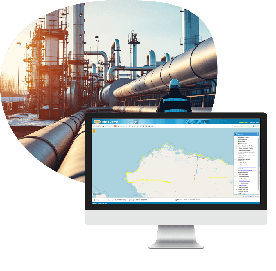
In Brief
A Clear Path to a PHMSA-Compliant Pipeline Data System
Preparing a first-time National Pipeline Mapping System (NPMS) submission is challenging when pipeline information exists across CAD files, engineering drawings, and legacy GIS layers. To build a compliant, unified pipeline data model, an Alaskan-based oil and gas operator partnered with Resource Data. Together, the teams implemented Esri’s Gas and Pipeline Referencing Utility Network Foundation and the Utility and Pipeline Data Model (UPDM).
The result was the operator’s first accurate, centralized, and NPMS-ready geospatial pipeline dataset and a modern geospatial foundation to support ongoing regulatory reporting and operational use.

The Challenges
Scattered Data Blocked Reliable Reporting and Readiness
The Pipeline and Hazardous Materials Safety Administration (PHMSA) rely on accurate geospatial pipeline data to support emergency responses, operations, and regulatory compliance. However, our client’s data was scattered across multiple locations and file types. This includes CAD files, spreadsheets, ground survey data, engineering drawings, and various GIS layers, making it difficult to maintain a clear consistent view of the network or generate PHMSA-compliant reports.
Building their first Esri UPDM system was essential for accurately managing data and producing a compliant NPMS ready data model. Without a compliant data model, the operator risked NPMS submission failure, regulatory penalties, and delays to future pipeline development.

The Solution
Centralized UPDM Framework for Pipeline Network Visibility and Compliance
To meet NPMS requirements and establish a compliant geospatial data pipeline, Resource Data implemented Esri’s Gas and Pipeline Referencing Utility Network Foundation, which includes the UPDM. The UPDM provides the standardized geodatabase structure used to organize pipeline information in ArcGIS Pro and deploy it into the client’s environment.
The model was first structured to represent key pipeline assets such as pipes, valves, and fittings that use subtypes for clear organization. Resource Data then configured domain lists, including approved pipe materials and valve types, to ensure consistent attribute entry. Once the structure was in place, the team digitized assets to create accurate geospatial features and attributes for each asset and added the required NPMS metadata, including primary, technical, and public contacts.
After building the model, it was deployed into the client’s ArcGIS Enterprise environment. This created a unified, compliant pipeline data system ready for our clients’ first NPMS submission and ongoing operational use.
Features
Inside the Framework: The Architecture Behind Accuracy
-
Centralized Geospatial Data Eliminates Scattered Records
Pipeline data and attributes from CAD files, engineering drawings, spreadsheets, and legacy GIS layers were merged into a single authoritative data model, eliminating scattered and inconsistent records.
-
Configured Editing Workflows for Ongoing Data Maintenance
Esri’s built-in ArcGIS Pro tasks and validation tools were configured to guide staff through data entry, editing, and quality checks, ensuring consistent updates across engineering, GIS, and operations teams.
-
Standardized Attribute Details Supports Reliable Reporting
The UPDM geodatabase captures essential attributes such as pipe material, valve type, diameter, installation year, and component classifications, providing consistent, structured information that supports operational workflows and NPMS reporting.
-
Detailed Component Representation Improves Network Visibility
Each pipeline element, including pipes, valves, fittings, and other components, was modeled as precise geospatial features with complete attribute details. This gives the operator a clear digital representation of the entire pipeline system.


“Resource Data has supported the NPMS submission processes for more than 5 north slope oil and gas operators and several in the lower 48.”
- Tasha Jackson, GIS Director, Resource Data

Results
A Fully Compliant, Enterprise-Ready Pipeline Data Model
With the UPDM and Utility Network in place, the operator is successfully prepared to submit its pipeline data to the National Pipeline Mapping System (NPMS) for the first time. The centralized model replaced scattered files with a clear, compliant pipeline model that meets PHMSA’s reporting requirements.




The practical starting point is to stop treating submission prep as a file-assembly exercise and instead build one authoritative geospatial data model that can absorb those sources in a controlled way. Resource Data’s case study shows that first-time NPMS readiness became possible for an Alaska oil and gas operator after they consolidated fragmented records into a centralized Esri-based pipeline model, then digitized assets and standardized their attributes and required metadata. That matters because NPMS submissions are not just maps; operators are expected to provide geospatial and attribute data plus contact information, and PHMSA uses NPMS data for compliance, inspections, and emergency response.
In this example, the business impact was lower regulatory risk, a clearer path to first submission, and a reusable operational foundation instead of a one-time reporting scramble.
It takes a standardized model, disciplined asset structure, controlled attribute values, and deployment into an environment where the data can be maintained over time. In Resource Data’s case study, the team implemented Esri’s Gas and Pipeline Referencing Utility Network Foundation and the Utility and Pipeline Data Model; organized pipeline assets such as pipes, valves, and fittings; configured domain lists for consistent entry; and added NPMS metadata (including primary, technical, and public contacts). That is a stronger approach than stitching together exports from legacy files because it creates a system that can support reporting and operations.
Resource Data’s example shows that the business impact is not only compliance readiness but also better data reliability, less manual reconciliation, and a more defensible reporting process when PHMSA requirements have to be met more than once.
A unified pipeline data model matters because the same information needed for compliant reporting is also what operations teams need for a trustworthy view of the network. Resource Data’s case study makes that point clearly: the operator did not just need a submission-ready file, they needed an accurate, centralized geospatial dataset that could support ongoing operational use after the first NPMS submission. PHMSA’s NPMS exists to support regulatory management, inspections, analysis, and emergency-response use cases, so weak underlying data creates risk on the reporting side and the operational side.
This example shows that when asset data is centralized and standardized, teams gain a clearer digital representation of the network, which improves visibility and reduces confusion created by scattered records. As a result, there is better coordination, lower reporting friction, and a data foundation that can scale without repeating the same cleanup effort every cycle.
They provide a structured framework for modeling the network consistently instead of leaving each team to define assets and fields its own way. In Resource Data’s case study, UPDM and the Gas and Pipeline Referencing Utility Network Foundation were used to organize pipes, valves, and fittings with clear subtypes; approved attribute domains; and required metadata needed for NPMS readiness. That kind of structure helps teams capture the same asset categories and data elements repeatedly, which is essential when PHMSA expects operators to submit geospatial data, attribute data, and contact information on an ongoing basis.
Resource Data’s example shows that the operational value of this approach is consistency across engineering, GIS, and operations work. The business value is reduced submission risk and less rework caused by inconsistent source records.
At a minimum, the model needs to represent the physical network clearly and capture the supporting information required for reporting and stewardship. Resource Data’s case study points to pipes, valves, and fittings specifically, along with structured attributes such as pipe material, valve type, diameter, installation year, and component classifications. It also notes that the implementation added required NPMS metadata, including primary, technical, and public contacts. That is important because PHMSA’s submission framework is broader than geometry alone. Operators are required to provide geospatial and attribute data as well as contact information, and first-time submitters are directed to complete several required submission components.
In Resource Data’s example, the business and operational impact was a more reliable dataset that could support regulatory submission, internal visibility, and future maintenance without depending on tribal knowledge or disconnected records.
They improve data quality by turning “data entry” into a governed process rather than a loose manual habit. Resource Data’s case study shows this in a very practical way. The team used subtypes to organize asset classes and configured domain lists for approved values such as pipe materials and valve types. They also set up ArcGIS Pro tasks and validation tools to guide staff through entry, editing, and quality checks. The real challenge is not only building the first compliant dataset but preserving its quality as multiple teams update it.
Resource Data’s example shows that the operational impact is more consistent maintenance across engineering, GIS, and operations. Results also included lower cleanup effort, fewer avoidable errors, and a better chance of being prepared for recurring NPMS obligations instead of rebuilding trust in the data every year.
They need shared workflows inside a common enterprise environment, not just a shared copy of a dataset. In Resource Data’s case study, the model was deployed into the client’s ArcGIS Enterprise environment and paired with configured editing tasks and validation tools in ArcGIS Pro so that different teams could update data in a controlled, consistent way. Instead of each discipline maintaining its own version of truth in drawings, spreadsheets, or side files, the organization works from one system designed for ongoing maintenance.
Resource Data’s example shows that this has direct operational value because it reduces conflicting updates and makes handoffs between teams cleaner. There is better scalability, less time wasted reconciling records, and a stronger compliance posture because the authoritative record remains usable beyond the first submission.
The main risks are inconsistent reporting, poor network visibility, higher submission failure risk, and delays that spill into broader pipeline work. Resource Data’s case study states this plainly: before the unified model, the operator’s data was spread across CAD files, spreadsheets, survey data, engineering drawings, and GIS layers. That made it hard to maintain a clear view of the network or generate PHMSA-compliant reports.
The case study also says that without a compliant data model, the operator faced the risk of NPMS submission failure, regulatory penalties, and delays to future pipeline development. Because PHMSA uses NPMS data for compliance, inspections, and emergency-response-related purposes, fragmented records created real regulatory and operational exposure. Resource Data’s example shows that the business impact of fixing this problem is risk reduction, faster readiness, and fewer downstream delays tied to weak data management.
It changes the work from episodic submission prep to sustained data stewardship. In Resource Data’s case study, the model was deployed into the client’s ArcGIS Enterprise environment after the asset structure, domains, and metadata were built. According to the case study, this created a unified, compliant pipeline data system ready for first submission and ongoing operational use. That matters because NPMS reporting is recurring, and PHMSA requires operators to update their data every 12 months or confirm no changes.
This example demonstrates that an enterprise deployment gives the operator a stable place to maintain the system over time rather than rebuilding compliance readiness from disconnected files each cycle. Resource Data’s work led to clearer network visibility and easier cross-team maintenance. It also helped with lower long-term reporting effort and a more reliable return on the initial data-model investment.
The biggest value is that it turns a compliance project into a reusable operational asset. Resource Data’s case study does not frame the outcome as “submission done”; it frames it as the operator’s first accurate, centralized, NPMS-ready geospatial dataset and a modern geospatial foundation for ongoing regulatory reporting and operational use. That distinction matters for buyers because a centralized model can reduce repeated manual cleanup, improve visibility into pipeline components, support better coordination across teams, and make future reporting cycles less disruptive. It also lowers the risk that regulatory work will stall future development because the organization is operating from fragmented records.
The case study shows that benefits to the business include cost avoidance, improved efficiency, and scalability without needing to recreate the same data-repair effort every time compliance deadlines or operational questions come up.
The model needs to capture the physical network at a level that is useful for reporting and day-to-day stewardship. In Resource Data’s case study, that included pipes, valves, fittings. It also included structured attributes such as material, valve type, diameter, installation year, and component classifications, along with required NPMS contact metadata. That combination matters because reliable reporting depends on more than centerlines.
Operations teams need asset detail that supports maintenance context and network understanding, while PHMSA expects operators to provide geospatial data, attribute data, and associated submission components. This case study shows that when those details are standardized in one model, the organization gets a cleaner submission path and a stronger base for operational visibility.